Creation and History of San Francisco’s 49 Mile Scenic Drive
Come walk a section with the Authors!
From the seagull street sign to the latest walking challenge, the history of San Francisco’s 49 Mile Scenic Drive covers SF.
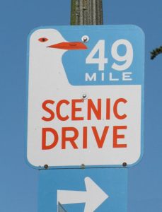
You’ve seen the 49 Mile retro route markers on signposts all over town. A white seagull, wing outstretched against a field of blue sky with orange lettering pointing you toward…. somewhere.
True confession: I grew up in San Francisco seeing those signs – and had no idea what they were or to where they were pointing.
You may be one of the thousands who have driven it, but If you are in the same wondering/wandering boat as I – don’t worry, you are about to get the inside scoop.
[HINT: The route goes in a counter-clockwise loop around the City.]
Now that I know, I find the creation and history of SF’s 49-Mile Scenic Drive fascinating!
So, what exactly is the 49 Mile Scenic Drive?
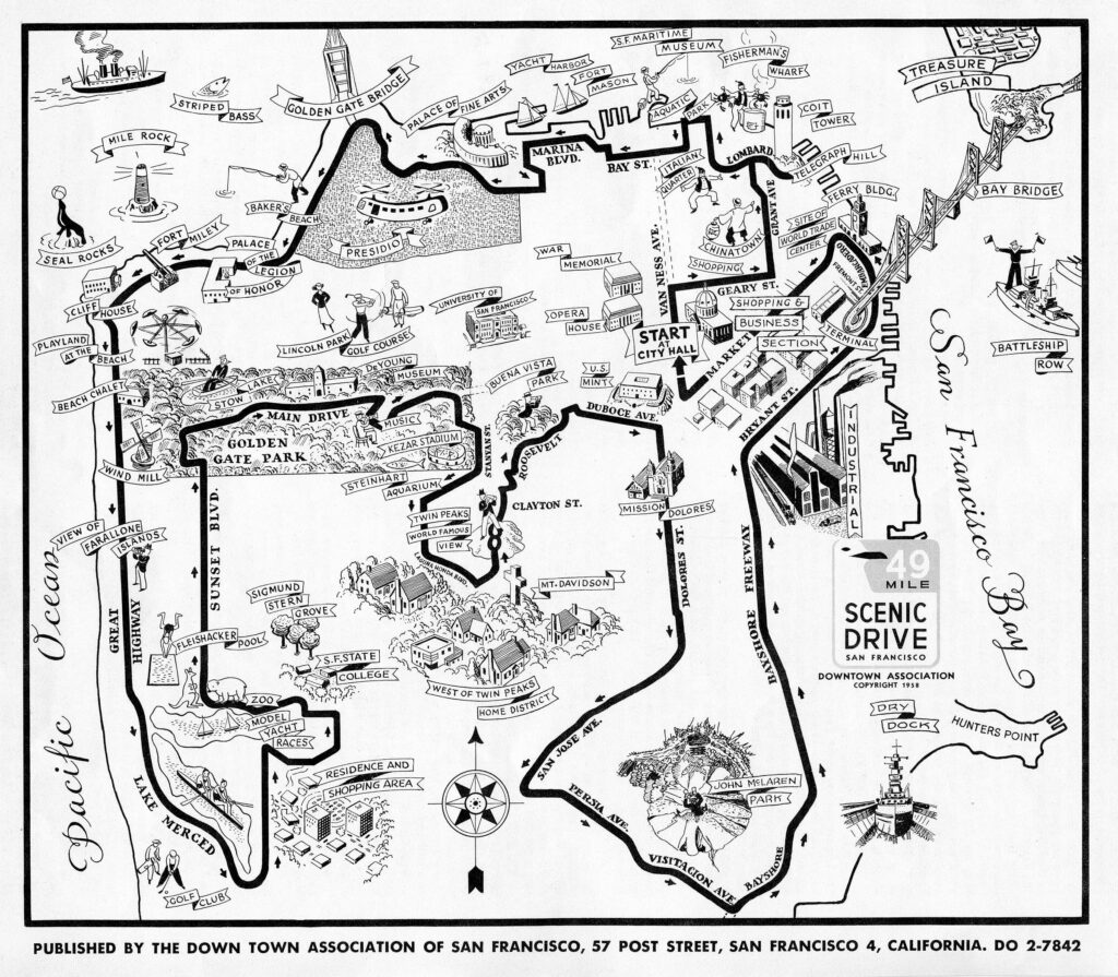
San Francisco’s 49 Mile Scenic Drive is an 80-year-old, loop-trail around the city designed to show off the city’s most famous landmarks and varied neighborhoods. Over 50 top tourist sites are on this route. It also takes you through the heart of real working neighborhoods all across town.
The Creation of the 49 Mile Scenic Drive
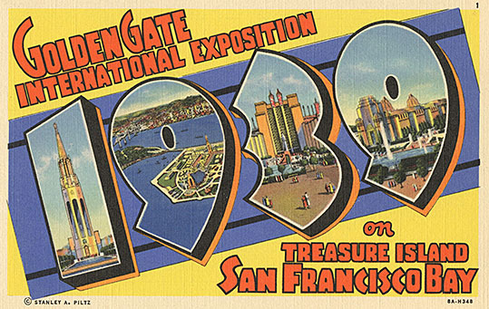
The 49 Mile Scenic Drive was conceived back in 1938 when the whole world had just been invited to visit San Francisco for the 1939-40 Golden Gate International Exposition to be held on Treasure Island (an artificial island built in San Francisco Bay specifically for the Expo.)
It may have been the height of the Great Depression, but San Francisco had proven time and time again— San Francisco knows how to rise from the ashes.
- We had two new bridges to show off —built in the middle of the Depression—the Golden Gate and SF Bay bridges.
- We were recognizing our place as the gateway to the Pacific.
- We had thrown two enormously successful Expos in the past: the California Midwinter International Exposition of 1894 and The Panama‑Pacific International Exposition of 1915.
- And with war looming in Europe and Asia, the organizers thought it couldn’t hurt to proclaim peace in the Pacific and invite everyone to get together. (We are an optimistic bunch!)
Besides, if a million visitors showed up there would be money flowing… and more pertinent to the history of the 49 Mile Scenic Drive…
…the Down Town Association wanted a way to get all those visitors off of Treasure Island and out into San Francisco’s neighborhoods, to marvel at her natural beauty—and think about doing business in San Francisco.
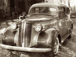 Automobile mania was sweeping the land. Someone at the Down Town Association wondered, “What if we created a driving route that toured people past the best sites and neighborhoods in the City?” They drew up a “50 Mile Scenic Drive” starting at City Hall and ending at Treasure Island, the site of the upcoming Fair.
Then it occurred to some fabulous PR guy (or gal), “Hmmm… San Francisco is 49 square miles, the Gold Rush happened in 1849… Let’s call it the 49 Mile Scenic Drive!”
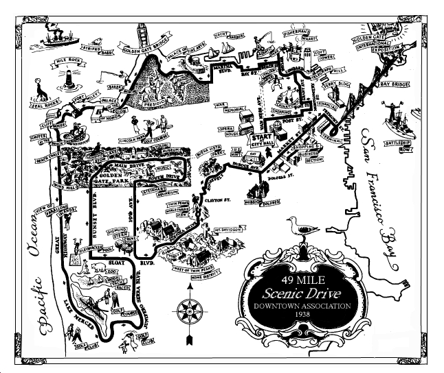
The new 49 Mile Scenic Drive was lined with black and yellow triangle markers to guide the way.
The route began at City Hall, curved along the northern shoreline of the bay and down the Pacific coastline, swooped around Lake Merced, dipped into Golden Gate Park, climbed to the top of Twin Peaks, cruised down Market Street, crossed the Bay Bridge, and ended on Treasure Island.
Inventing Tourist Attractions
Along the way the Down Town Association invented some new tourist attraction, such as Fisherman’s Wharf. Until then, the wharf had been an industrial spot.
Promoting Neighborhoods
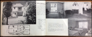 The City and developers were also creating the “Sunset District.” Sunset Boulevard had recently been carved out of the sand dunes (1931). Developers, like Henry Doelger, were designing and building tract housing blocks at a time. And as it so happened, when you finished the Drive, you could stop by a model home show on Treasure Island, where you could pick out, and order your very own new home in San Francisco (or Marin). [right] Model Home Album from 1939-40 Golden Gate International Expo
Celebrity Endorsements
President Franklin D. Roosevelt came to visit the Bay Area on July 14, 1938, and a clever PR person might claim he drove part of the Drive (well, he did a loop around the Civic Center, Treasure Island and crossed SF’s two new bridges.)
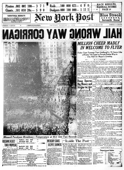
A few days later, on July 17, 1938, American aviator Douglas Corrigan took off in his experimental plane for a transcontinental flight from New York City to Los Angeles—and ended up in Dublin, Ireland instead.
His fame as one of the mechanics who helped build Charles Lindberg’s Spirit of St Louis plane was quickly eclipsed by his new adventure and his permanent new nickname “Wrong Way” Corrigan.
Corrigan’s Adventure gave the Down Town Association’s PR pro an idea. Two months later…
Sept. 14, 1938—the official opening
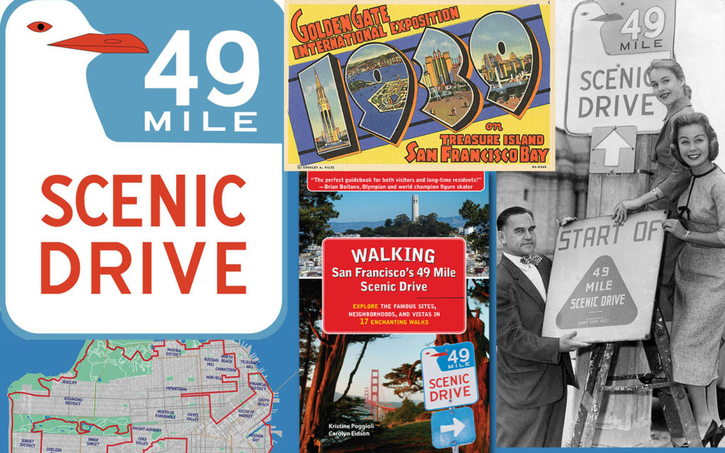
On September 14, 1938, the 49-Mile Scenic Drive was officially opened by Douglas “Wrong Way” Corrigan, who drove (at least part of) the route in reverse on that day. The “drive” was a hit.
The public embraced the 49 Mile Scenic Drive and families, visitors, dignitaries, cyclists—and now urban hikers—have been traveling its path ever since. (Former SF Supervisor Angela Alioto remembers riding part of it on horseback in her youth!)
The Fair Ends—the Route Changes
Though the Golden Gate Expo began with hopes of peace in the Pacific it ended to the drumbeats of war.
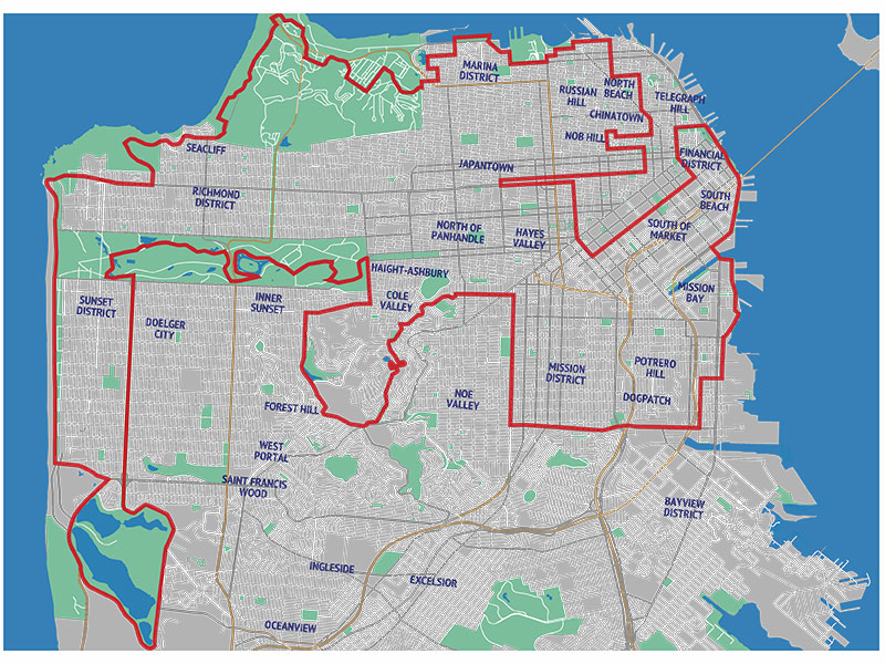
The history of the 49 Mile Drive includes a number of route and distance changes over the years, first for World War II security and then to showcase new freeways and booming neighborhoods. Notably:
- The segment to Treasure Island (which became a Naval Air Base) was removed immediately.
- Since 1947, the route has begun and ended at City Hall.
- It has expanded out to the southeast part of the City past Mission Dolores (for a while it even went out to The Excelsior and Visitacion Valley, though no more).
- There have been a few reroutings for prettier sites and less crowded streets (no more waiting in traffic along 19th Ave or to head up to Coit Tower!)
- The car-friendly reroutings onto the 280 freeway and Cesar Chavez and Howard Streets, well, aren’t exactly the pretty parts of town, but they are real life San Francisco experiences.
Today, the Walking version of the route has added Dogpatch and Mission Bay. (get the walking guidebook)
The Creation of the Totally Cool Seagull Sign
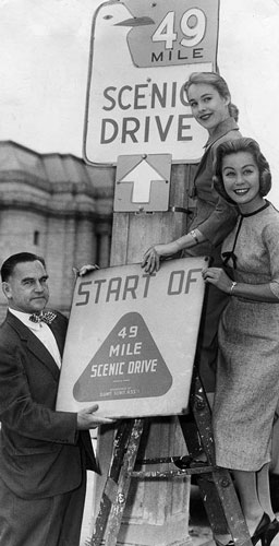 The original 49 Mile route marker was a black and yellow triangle. In 1954 the Down Town Association held a contest to come up with a new design (another successful marketing gimmick—dang they are good). More than 100 entrants competed.
The winner—and still reigning champion—is a white seagull, wing outstretched against a field of blue sky, with orange lettering announcing the route. That graphic, designed by local artist Rex May, is recognized all over the world and many visitors refer to the “seagull route.”
In fact, the seagull street sign is so cool and popular that people keep stealing the signs. Stop it! You can buy your own gorgeous replica here.
In 1968 responsibility for promoting the 49 Mile Scenic Route was assumed by the San Francisco Convention & Visitors Bureau (which became the San Francisco Travel Association in 2011).
Signage along the route is installed and maintained by the San Francisco Department of Parking & Traffic, part of the Municipal Transportation Agency. (If you see a missing sign, call them to request a replacement.)
And now, for its 80th anniversary, San Francisco’s 49 Mile Scenic Drive has been reinvented as a green healthy walking adventure for a new generation. Come take the challenge to walk it in 17 bite-size walks over the course of one year!
With all the changes, one thing has never changed; the glamour and beauty of this special city continue to draw visitors and locals alike to this 49-mile adventure over her steep hills, through her distinctive neighborhoods, and past her breathtaking vistas.
